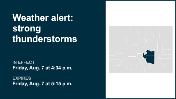
An updated report was issued from the National Weather Service on Friday at 4:34 p.m. for strong thunderstorms until 5:15 p.m. for Canon City Vicinity/Eastern Fremont County, Colorado Springs Vicinity/Southern El Paso County/Rampart Range below 7,400 ft and Pueblo Vicinity/Pueblo County below 6,300 feet.
The storms may bring pea-sized hail (0.25 inches) and wind gusts of up to 50 mph.
“At 4:33 p.m., Doppler radar tracked a strong thunderstorm 7 miles northeast of Penrose, or 22 miles northwest of Pueblo, moving south at 20 mph,” says the NWS. “Gusty winds could knock down tree limbs and blow around unsecured objects. Minor hail damage to vegetation is possible.”
The alert is for Penrose, open country of east central Fremont and southern El Paso and northwest Pueblo counties.
The NWS adds, “If outdoors, consider seeking shelter inside a building.”
Lightning on the horizon: Expert safety measures for thunderstorms
Lightning strikes the United States approximately 25 million times each year, mostly during the summer. Lightning claims the lives of about 20 people annually, according to the NWS. The risk of lightning-related incidents escalates as thunderstorms draw near, reaching its peak when the storm directly looms overhead. However, it gradually recedes as the tempest moves
To ensure your safety during a thunderstorm, keep these recommendations in mind:
Lightning safety plan:
• When venturing outdoors, it’s crucial to have a lightning safety plan in place.
• Stay vigilant by monitoring the sky for ominous signs and listening for the telltale sound of thunder. If thunder is audible, it’s a clear indication of nearby lightning.
• Seek a safe place to shelter, preferably indoors.
Indoors safety measures:
• Once you’re indoors, avoid using corded phones, electrical devices, plumbing fixtures, and stay away from windows and doors.
• Lightning can follow conductive pathways, and these precautions reduce the risk of electrical surges.
Wait for the all-clear:
• After the last lightning strike or thunderclap, wait at least 30 minutes before resuming outdoor activities.
• It’s important to remember that lightning can strike even when a storm seems to have passed, so exercise caution.
When indoor shelter isn’t available:
If you find yourself outdoors without access to indoor shelter during a thunderstorm, take these steps to maximize your safety:
• Avoid open fields, hilltops, or ridge crests, which expose you to greater lightning risk.
• Steer clear of tall, isolated trees and other prominent objects. In wooded areas, stay close to lower stands of trees.
• If you’re with a group, ensure individuals are spread out to prevent lightning current from transferring between people.
• Camping in an open setting during a thunderstorm is strongly discouraged. If no alternative exists, set up camp in a valley, ravine, or other low-lying areas. Remember that a tent offers no protection against lightning.
• Do not approach water bodies, wet objects, or metal items. While water and metal don’t attract lightning, they conduct electricity effectively and can pose significant risks.
In summary, when facing the threat of lightning, preparedness and vigilance are your best allies. By following these guidelines, you can significantly reduce the likelihood of lightning-related incidents and prioritize your safety.
Navigating heavy rain: Essential safety measures for wet roads
When heavy rain sets in, the risk of flooding and hazardous driving conditions rises. Whether it’s prolonged rainfall or rapid runoff, being prepared is essential. Here are some valuable safety tips from the NWS to ensure you stay safe in heavy rain:
Beware of swollen waterways:
In heavy rain, refrain from parking or walking near culverts or drainage ditches, where swift-moving water can pose a grave danger.
Maintain safe driving distances:
Adhere to the two-second rule for maintaining a safe following distance behind the vehicle in front of you. In heavy rain, allow an additional two seconds of distance to compensate for reduced traction and braking effectiveness.
Slow down and stay cautious:
On wet roads, reducing your speed is crucial. Ease off the accelerator gradually and avoid abrupt braking to prevent skidding.
Choose your lane wisely:
Stick to the middle lanes on multi-lane roads to minimize the risk of hydroplaning, as water tends to accumulate in outer lanes.
Visibility matters:
Enhance your visibility in heavy rain by activating your headlights. Be particularly vigilant for vehicles in blind spots, as rain-smeared windows can obscure them.
Watch out for slippery roads:
Be extra careful during the first half hour after rain begins. Grime and oil on the road surface mix with water to make the road slippery.
Keep a safe distance from large vehicles:
Large trucks and buses can reduce your visibility with tire spray. Avoid tailgating and pass with caution.
Mind your windshield wipers:
Overloaded wiper blades can hinder visibility. If rain severely impairs your vision, pull over and wait for conditions to improve. Seek refuge at rest areas or sheltered spots.
When stopping by the roadside is your only option, position your vehicle as far off the road as possible, ideally beyond guardrails. Keep your headlights on and activate emergency flashers to alert other drivers of your position.
In the face of heavy rain, these precautions can make a significant difference in ensuring your safety on the road. Remember to stay informed about weather conditions and heed guidance from local authorities for a secure journey.
Source: The National Weather Service