SOUTHLAND DISTRICT, Southland Region — Monday night, a 6.3 magnitude quake was recorded near Riverton, according to the U.S. Geological Survey.
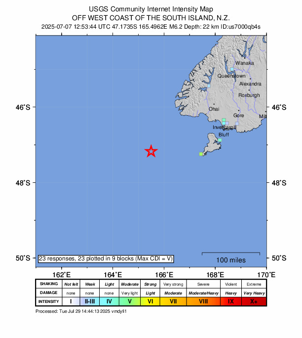
A tremor rocked the area at 12:53 UTC (23:53 local time). The earthquake’s epicenter was situated approximately 213 km west-southwest of Riverton and occurred at a depth of 22 km.
Did you feel it?
Those who experienced the quake are encouraged to report it through the USGS Felt Report form. The agency has so far received 23 reports via its online form from people who say they felt the tremor. According to the USGS DYFI report, moderate shaking was registered and residents in cities such as Queenstown, Wallacetown, Invercargill and Bluff reported experiencing the earthquake.
Impact and estimated losses
Green alert for shaking-related fatalities and economic losses. There is a low likelihood of casualties and damage.
Structure information summary
Overall, the population in this region resides in structures that are highly resistant to earthquake shaking, though some vulnerable structures exist. The predominant vulnerable building types are reinforced masonry and unreinforced brick with timber floor construction.
Historical information
A magnitude 6.9 earthquake 270 km northeast of this event struck Secretary Island, New Zealand on August 10, 1993 (UTC), with estimated population exposures of 5,000 at intensity VI and 2,000 at intensity VII, with no reported fatalities.
Source: The U.S. Geological Survey