HAWAII COUNTY, HI — A 6.0 magnitude quake shook close to Honaunau-Napoopoo on Saturday night, according to the U.S. Geological Survey.
The tremor hit at 7:46 a.m. (9:46 p.m. local time), with its epicenter approximately 8 miles south of Honaunau-Napoopoo and a depth of 14 miles.
Did you feel it?
You can let the USGS know if you noticed the earthquake by filling out their Felt Report form. 7205 people have submitted responses through the agency’s online form, indicating they felt very strong shaking. According to the USGS DYFI report, residents in cities including Princeville, Kilauea, Waimea, Hanapepe and Kapaa reported experiencing the quake.
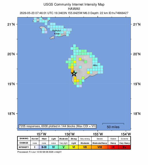
Impact and estimated losses
Yellow alert for economic losses. Some damage is possible and the impact should be relatively localized. Estimated economic losses are less than 1% of GDP of the United States. Past events with this alert level have required a local or regional level response Green alert for shaking-related fatalities. There is a low likelihood of casualties. Recent earthquakes in this area have caused secondary hazards such as landslides that might have contributed to losses.
Structure information summary
Most structures in this region are resistant to earthquake shaking, though vulnerable structures exist. The predominant vulnerable building types are unreinforced brick masonry and reinforced masonry construction.
Tremors past week
Last week, the area has experienced 16 earthquakes with a magnitude 2.5 or greater. The strongest, a 3.0 magnitude quake, was detected close to Pāhala on May 21.
Last week’s five largest nearby quakes:
• 3.0, northwest of Pāhala on May 22
• 2.9, west of Kalaoa on May 19
• 2.8, south-southeast of Pāhala on May 21
• 2.8, east-southeast of Honaunau-Napoopoo on May 18
• 2.7, north of Pāhala on May 21
Detailed tectonic summary
The May 23, 2026, magnitude 6.0 earthquake occurred due to oblique reverse faulting at a depth of 22 km (14 miles). Large magnitude earthquakes in Hawaii that occur at this depth are typically caused by lithospheric flexure due to the weight of the Hawaiian Islands pressing down on the underlying oceanic plate. Given the depth, location and the observed typical mainshock-aftershock behavior, the May 23 event is not directly related to magmatic processes.
The Island of Hawaii is the youngest island in a chain of volcanoes that stretches about 5,500 km across the northern Pacific Ocean. The island chain results from magma generated by a source deep within the mantle, the Hawaiian hotspot. The ocean crust and lithosphere above the hotspot, within the Pacific tectonic plate, move to the northwest with respect to the deep magma source. Over millions of years, new island volcanoes form, and older volcanoes are carried away from the hotspot (towards the northwest), erode, and eventually subside beneath sea level.
Non-volcanic or non-magmatic Hawaiian earthquakes reflect the long-term accumulation and release of lithospheric stresses rather than short-term processes associated with the motion of magma before or during an eruption. The long-term stresses are partly generated in the crust and mantle by the weight of the volcanic rock that composes the islands. In that sense, most Hawaiian earthquakes not directly associated with eruptions are nonetheless broadly related to volcanic activity.
Moderate-magnitude earthquakes are common in Hawaii. In the last 50 years, there have been 36 other earthquakes of magnitude 5 or greater within 100 km (60 mi) of the May 23, 2026, event. Hawaii has also experienced larger earthquakes, including the M 7.7 Kalapana earthquake in 1975 and the M 6.7 Kīholo Bay earthquake that caused minor injuries, damaged roads and at least 1,000 buildings, and triggered landslides that blocked roads on Hawaii.
Source: The U.S. Geological Survey