BAHAGIAN PANTAI BARAT, Sabah — According to the U.S. Geological Survey, a 7.0 magnitude quake slammed near Kota Belud at midnight on Sunday.
The tremor, which hit the area at 16:57 UTC (00:57 local time), was centered roughly 55 km north-northwest of Kota Belud. It occurred at a depth of 629 km. The magnitude was originally reported as 7.1 but later downgraded to 7.0.
Did you feel it?
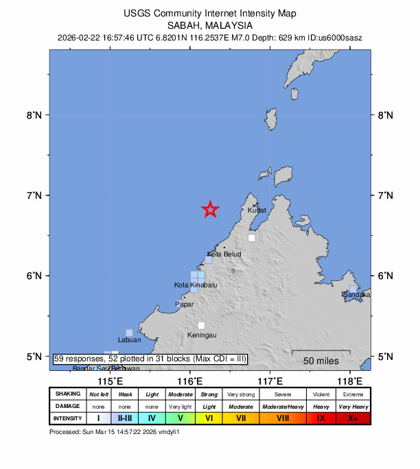
If you noticed the earthquake, you can share your experience using the USGS Felt Report form. So far, the agency has collected 59 online responses from individuals saying that they experienced the quake. Weak shaking has been detected and residents reported feeling the tremor in multiple cities, including Miri, Tawau, Bandar Seri Begawan and Sandakan based on the USGS DYFI report.
Impact and estimated losses
Green alert for shaking-related fatalities and economic losses. There is a low likelihood of casualties and damage.
Structure information summary
Overall, the population in this region resides in structures that are highly vulnerable to earthquake shaking, though some resistant structures exist. The predominant vulnerable building types are unreinforced brick with concrete floor and precast concrete frame with wall construction.
Detailed tectonic summary
The February 22, 2026, M 7.1 earthquake occurred below Sabah, Malaysia (near the north end of the island of Borneo) as a result of strike-slip or oblique strike-slip and reverse faulting at a deep depth of approximately 620 km below the surface. Southeast Asia is a tectonically complex and active region where large earthquakes are relatively common. However, the region where today’s earthquake occurred is relatively quiet seismically. This is the first magnitude 7 or larger earthquake since 1950 to occur within 250 km of the epicenter. Only two earthquakes of M6 or larger have occurred since 1950 in that region – a M6.0 in 2015 and a M6.1 in 1951, both at much shallower depths. A few 600+ km deep but much smaller earthquakes have been observed in this zone since 2019, the largest of which was a M 5.5 event on April 2, 2023.
Earthquakes with focal depths greater than 300 km are called “Deep-focus” earthquakes. Deep-focus earthquakes cause less damage on the ground surface above their foci than similar-magnitude shallow-focus earthquakes. Still, large deep-focus earthquakes may be felt at great distances from their epicenters. Earthquakes at this depth typically occur within subducting slabs, which are relatively cool compared to the surrounding mantle. In this case, the slab structure is not well known, but the event may have occurred within a slab remnant.
Source: The U.S. Geological Survey