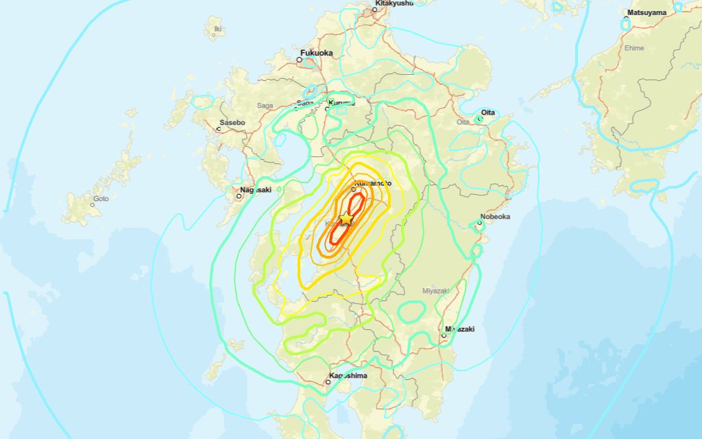
A 6.8 magnitude quake occurred near The Kumamoto Region on Tuesday afternoon, according to the U.S. Geological Survey.
A tremor rocked the area at 07:27 UTC (16:27 local time). The earthquake’s epicenter was of The Kumamoto Region and occurred at a depth of 10 km.
Did you feel it?
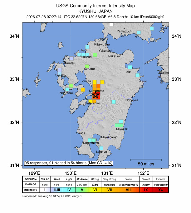
You can let the USGS know if you noticed the quake by filling out their Felt Report form. The agency has so far received 95 reports via its online form from people who say they experienced severe to violent shaking. According to the USGS DYFI report, residents in cities such as Ōsaka, Fuchū (E of Hiroshima), Iwakuni, Ōita and Fukuoka reported feeling the tremor.
Impact and estimated losses
Red alert for economic losses. Extensive damage is probable and the disaster is likely widespread. Estimated economic losses are less than 1% of GDP of Japan. Past events with this alert level have required a national or international level response Orange alert for shaking-related fatalities. Significant casualties are likely. Recent earthquakes in this area have caused secondary hazards such as landslides that might have contributed to losses.
Structure information summary
Overall, the population in this region resides in structures that are resistant to earthquake shaking, though vulnerable structures exist. The predominant vulnerable building types are heavy wood frame and reinforced/confined masonry construction.
Detailed tectonic summary
The July 28, 2026, M 6.8 earthquake south of Kumamoto, on the island of Kyushu in southwest Japan, occurred as the result of shallow strike‑slip faulting. Focal mechanisms indicate that the slip took place either on a left‑lateral fault striking northwest or on a right‑lateral fault striking northeast. Most seismicity in the Kyushu region is associated with the deep subduction of the Philippine Sea plate. While the earthquake occurred several hundred kilometers northwest of the Ryukyu Trench, where the Philippine Sea plate begins its northwestward subduction beneath Japan and the Eurasia plate, the shallow depth and faulting style of this event indicate it occurred on a crustal fault within the upper Eurasia plate. At this location, the Philippine Sea plate converges with the Eurasia plate toward the northwest at a rate of 58 mm per year.
Today’s earthquake is located in the same region as a deadly earthquake sequence in April 2016. That sequence included two foreshocks, M 6.2 and M 6.0, followed one day later by a M 7.0 mainshock. The foreshocks to the April 2016 M 7.0 event caused at least nine fatalities and injured more than 800 people, while the M 7.0 mainshock killed at least 40 people immediately from shaking‑related damage, with several hundred additional deaths resulting from injuries and illnesses linked to the earthquake, and injured more than 2,000.Approximately 12,000 houses were damaged or destroyed by the 2016 M7.0 earthquake, and the Aso Ohashi Bridge in Minamiaso collapsed into the Kurokawa River due to a landslide triggered by the quake.
Source: The U.S. Geological Survey