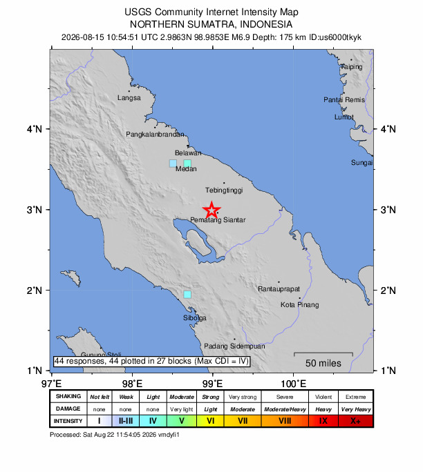
SIMALUNGUN REGENCY, North Sumatra — A 6.9 magnitude quake hit close to Pematangsiantar on Saturday afternoon, according to the U.S. Geological Survey.
The tremor rocked at 10:54 UTC (17:54 local time), with its epicenter roughly 9 km west-northwest of Pematangsiantar and a depth of 175 km.
Did you feel it?
If you noticed the earthquake, you can report it via the USGS Felt Report form. The agency has so far received 44 reports via its online form from people who say they felt weak shaking. Residents reported experiencing the quake in several cities, including Tanjong Bunga, Georgetown, Kuala Lumpur and Sungai Ara based on the USGS DYFI report.
Impact and estimated losses
The USGS categorized this as a Green Alert, which means there is a low likelihood of casualties and damage. Recent earthquakes in this area have caused secondary hazards such as landslides that might have contributed to losses.
Structure information summary
Overall, the population in this region resides in structures that are vulnerable to earthquake shaking, though resistant structures exist. The predominant vulnerable building types are informal (metal, timber, GI etc.) and heavy wood frame construction.
Area struck by 8.6 quake in 2005
Aceh Singkil Regency has faced strong earthquakes before. A magnitude 8.6 tremor struck 48.5 miles west-southwest of Singkil on Mar. 28, 2005, at a depth of 18.6 miles.
Source: The U.S. Geological Survey