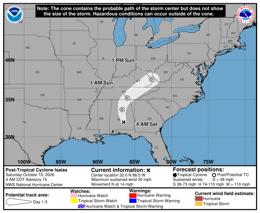
Article first published: Saturday, Oct. 10, 2026, 4 a.m. ET
Article last updated: Saturday, Oct. 10, 2026, 10 p.m. ET
System type: Hurricane, Category 1
System name: Isaias
The National Hurricane Center’s 10 p.m. Saturday advisory reported that Isaias’s journey: passing Alabama and moving to Tennessee. Category 1 Hurricane Isaias is 75 miles south of Nashville Tennessee and 405 miles west-southwest of Roanoke Virginia. The hurricane is moving northeast at 16 mph, with maximum sustained winds of 25 mph.
“Little change in strength is forecast during the next 24-36 hours before the cyclone is absorbed by another low pressure system to its east,” analysts explained about the hurricane.
Yesterday (Friday)
There were many developments, particularly at night. Isaias was a Category 3 hurricane, before weakening to a Category 2 hurricane. Then, it was downgraded to a Category 1 hurricane with sustained winds of 90 mph.
Hazards affecting land
Rainfall. Additional Rainfall totals of 2 to 5 inches with localized maximum amounts of 10 inches are possible across the Southern Appalachians from the western Carolinas into western Virginia. Additional rainfall totals of 1 to 2 inches across the Florida Big Bend and northwest Florida bringing storm totals towards 12 inches. Rainfall amounts of 2 to 4 inches with localized maximum amounts to 6 inches are possible near the coasts of the Carolinas.
Flash, urban, and river flooding is possible across the region, with considerable impacts, including landslides, possible across the southern Appalachians. Significant river flooding across the western Florida Panhandle will crest today through Sunday.
For a complete forecast of rainfall associated with Isaias, please see the National Weather Service Storm Total Rainfall Graphic available at hurricanes.gov/graphics_at4.shtml?rainqpf and the Flash Flood Risk graphic at hurricanes.gov/graphics_at4.shtml?ero.
Tornadoes. A couple of tornadoes are possible tonight across eastern Georgia and the Carolinas.
Wind. Strong wind gusts continue to pose a threat across the southeastern United States today, particularly near the Southern Appalachians. Scattered power outages and downed trees and powerlines may occur, with the risk highest in elevated terrain.
Surf. Swells from Isaias will continue to affect much of the Gulf coasts of the United States, Mexico, and western Cuba this weekend. These swells are likely to cause life-threatening surf and rip current conditions.
A depiction of rip current risk for the United States can be found at: hurricanes.gov/graphics_at4.shtml?ripCurrents
Source: National Hurricane Center