Article first published: Thursday, Oct. 22, 2026, 4 a.m. CDT
Article last updated: Thursday, Oct. 22, 2026, 4 p.m. CDT
System type: Post-tropical cyclone
System name: Josephine
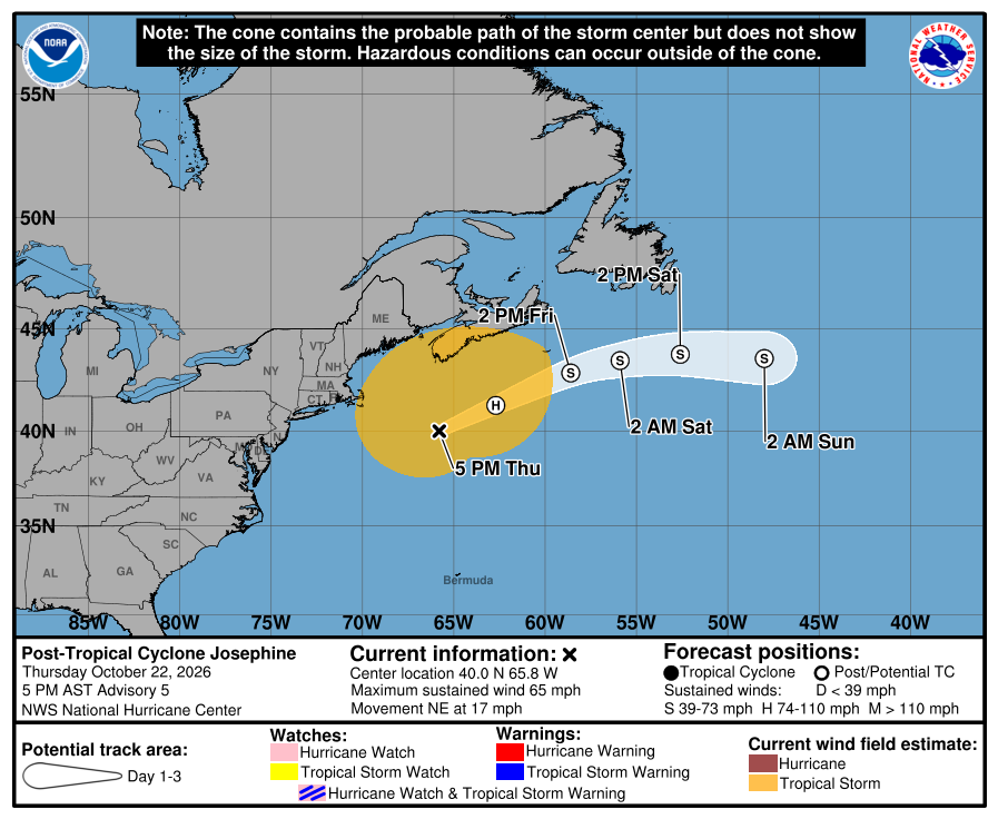
The post-tropical cyclone system was last addressed in a final advisory by the National Hurricane Center at 4 p.m. Thursday. Josephine became a post-tropical cyclone with sustained winds of 65 mph after weakening from subtropical storm. Post Tropical Cyclone Josephine is in the Atlantic Ocean, 235 miles east-southeast of Nantucket Massachusetts and 335 miles south-southwest of Halifax Nova Scotia. It is moving northeast at 17 mph, with maximum sustained winds of 65 mph.
“A gradual turn toward the east is forecast on Friday and into the weekend,” meteorologists noted. “On the forecast track, Josephine should move away from the United States and remain south of Nova Scotia and Newfoundland during the next couple of days.” They also said “Strengthening is forecast through tonight, and Josephine is expected to become a powerful extratropical cyclone with hurricane-force winds tonight or early Friday.”
Hazards affecting land
Wind. Gale-force winds are possible in gusts along portions of the northeastern United States coast through this evening.
Coastal flooding. Minor to locally moderate coastal flooding is ongoing along portions of the U.S. Mid-Atlantic coast and will continue through the rest of the week around times of high tide.
Surf. Large swells generated by Josephine are affecting much of the eastern seaboard of the United States and portions of Atlantic Canada. These swells are likely to cause life-threatening surf and rip current conditions.
A depiction of rip current risk for the United States can be found at: hurricanes.gov/graphics_at5.shtml?ripCurrents
Source: National Hurricane Center