YAKUTAT CITY AND BOROUGH, AK — A 7.0 magnitude quake was detected near Hubbard Glacier Earthquake around midday Saturday, the U.S. Geological Survey reported.
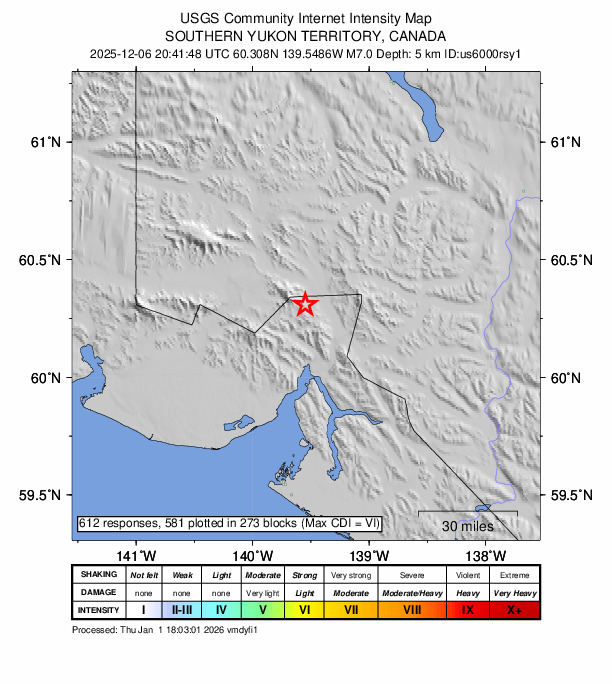
A tremor shook the area at 8:41 p.m. (11:41 a.m. local time). The earthquake’s epicenter was located of Hubbard Glacier Earthquake and occurred at a depth of just 3 miles. The magnitude was originally reported as 6.7 but later upgraded to 7.0.
Did you feel it?
If you felt the quake, you can share your experience using the USGS Felt Report form. The agency has received 612 responses on its online form so far, from people saying they experienced the tremor. Moderate to strong shaking was observed, with reports from cities such as North Pole and Anchorage indicating that the earthquake was felt, according to the USGS DYFI report.
Impact and estimated losses
Green alert for shaking-related fatalities and economic losses. There is a low likelihood of casualties and damage. Recent earthquakes in this area have caused secondary hazards such as tsunamis that might have contributed to losses.
Structure information summary
Overall, the population in this region resides in structures that are resistant to earthquake shaking, though vulnerable structures exist. The predominant vulnerable building types are unreinforced brick masonry and reinforced masonry construction.
Detailed tectonic summary
The December 6, 2025 magnitude 7.0 earthquake near the Yakutat Peninsula of Alaska and the US-Canadian border occurred as the result of oblique slip along or near the plate boundary between the Pacific and North America plates. The earthquake mechanism is consistent with a combination of thrust and right-lateral strike slip motion, in the vicinity of the Fairweather Fault. The Fairweather Fault is a major plate boundary fault in the region, and is the northern portion of the Queen Charlotte Fault that extends along much of the western offshore coast of Canada. In south central Alaska, the Fairweather-Queen Charlotte Fault transitions into the Alaska-Aleutians subduction zone in a region of complex tectonics and seismicity termed the Yakutat block. Earthquakes in this region exhibit a range of faulting styles and depths that are indicative of the complex tectonic interactions.
This plate boundary region has produced major earthquakes in the past, including the 1958 M7.8 Lituya Bay earthquake (which caused a massive landslide-triggered tsunami in Lituya Bay), and represents a major hazard in the region. Since 1950, there have been 16 other magnitude 6 or larger earthquakes in the surrounding 320 km, including the 1979 magnitude 7.1 McCarthy earthquake, a thrust event west of the December 6 earthquake. In 1987, a magnitude 7.9 strike slip earthquake occurred offshore near the southwest edge of the Yakutat block in the Gulf of Alaska.
Source: The U.S. Geological Survey