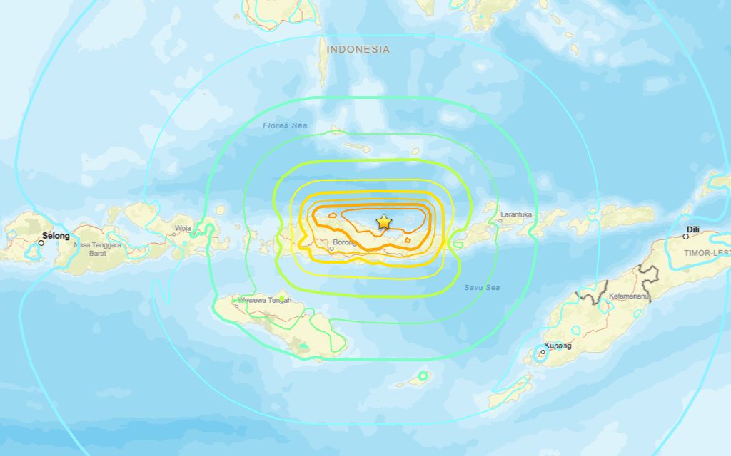
A 7.8 magnitude quake occurred close to Ende on Friday morning, the U.S. Geological Survey reported.
The USGS reported a tremor in the region at 21:58 UTC (05:58 local time). The epicenter was roughly 64 km north-northwest of Ende, at a depth of 10 km. The magnitude was originally reported as 7.7 but later upgraded to 7.8.
Did you feel it?
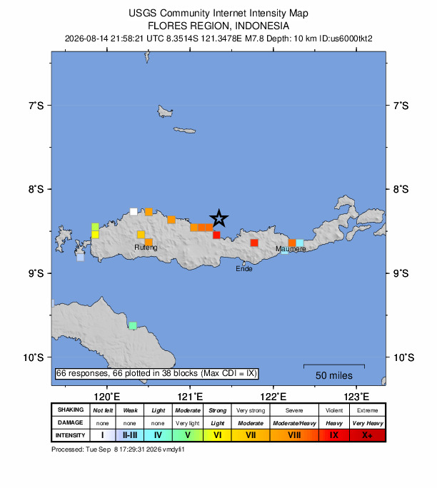
If you noticed the earthquake, you can share your experience using the USGS Felt Report form. The agency has so far received 66 reports via its online form from people who say they experienced severe to violent shaking. According to the USGS DYFI report, residents in cities including Kuta, Denpasar, Ubud and Ruteng reported feeling the quake.
Impact and estimated losses
Orange alert for shaking-related fatalities and economic losses. Significant casualties and damage are likely and the disaster is potentially widespread. Past orange alerts have required a regional or national level response Estimated economic losses are less than 1% of GDP of Indonesia. Recent earthquakes in this area have caused secondary hazards such as tsunamis and landslides that might have contributed to losses.
Structure information summary
Overall, the population in this region resides in structures that are vulnerable to earthquake shaking, though resistant structures exist. The predominant vulnerable building types are unreinforced brick with concrete floor and precast concrete frame with wall construction.
Detailed tectonic summary
The August 14, 2026, M7.7 Flores Sea earthquake occurred off the northern coast of East Nusa Tenggara, Indonesia, as the result of reverse faulting at shallow depth. The earthquake is located in a seismically active area dominated by convergence between the Australia and Sunda plates. Focal mechanism solutions indicate that the rupture occurred on either a west-striking fault dipping moderately to the north or an east-striking fault dipping shallowly to the south. The location, depth, and preliminary focal mechanism solution for this earthquake indicate the event is likely the result of thrust faulting within the overriding Sunda plate. At the location of this earthquake, the Australian plate is moving towards the north with respect to the Sunda plate at approximately 69 mm/yr. These two plates meet at the Sunda Trench, located approximately 350 km south of this earthquake.
While commonly plotted as points on maps, earthquakes of this size are more appropriately described as slip over a larger fault area. Reverse-faulting events of the size of the August 14, 2026, earthquake are typically about 90 by 45 km in size (length x width).
Earthquakes are common in this region. Since 1950, there have been 37 other earthquakes of magnitude 6 and greater, including five other earthquakes of magnitude 7 and larger within 250 km of the August 14, 2026, earthquake. In 1992, a M7.8 earthquake occurred just 63 km east-southeast of the August 14, 2026, earthquake. The 1992 earthquake and resulting tsunami destroyed tens of thousands of homes and resulted in at least 2500 fatalities.
Source: The U.S. Geological Survey