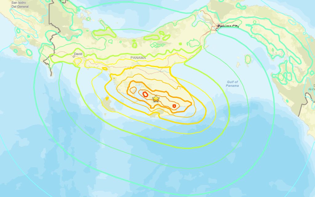
A 7.7 magnitude quake occurred close to Pitaloza Arriba around midday Friday, the U.S. Geological Survey reported.
The USGS reported a tremor in the region at 17:56 UTC (12:56 local time). The epicenter was about 12 km west-southwest of Pitaloza Arriba, at a depth of 13 km. Seismologists first reported it as a 8.0 event, but later downgraded it to 7.7.
Did you feel it?
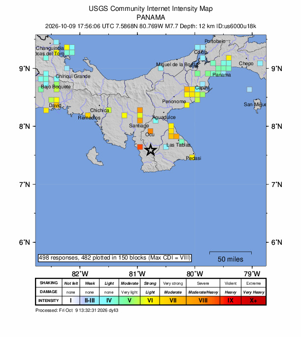
If you noticed the earthquake, you can share your experience using the USGS Felt Report form. So far, the agency has collected 498 online responses from people saying they felt very strong shaking. According to the USGS DYFI report, residents in cities such as Bogotá, Pereira, La Ceja and Itagüí reported experiencing the quake.
Impact and estimated losses
Red alert for economic losses. Extensive damage is probable and the disaster is likely widespread. Estimated economic losses are 0-9% GDP of Panama. Past events with this alert level have required a national or international level response Yellow alert for shaking-related fatalities. Some casualties are possible. Recent earthquakes in this area have caused secondary hazards such as tsunamis, landslides and liquefaction that might have contributed to losses.
Structure information summary
Overall, the population in this region resides in structures that are a mix of vulnerable and earthquake resistant construction. The predominant vulnerable building types are unreinforced brick masonry and adobe block construction.
Detailed tectonic summary
Panama is located near the junction of several major tectonic plates, including the oceanic Cocos and Nazca plates to the west and south, and the Caribbean and South America plates to the north and east, respectively. These larger plates surround the Panama microplate. Along the southern boundary, the Cocos and plate subducts and beneath the Panama microplate and the Nazca plate obliquely converges with the microplate, while along its northern boundary, the Caribbean Plate subducts beneath it. The earthquake’s focal mechanism indicates left-lateral strike-slip faulting, consistent with the style of deformation commonly observed along this complex plate boundary.
Earthquakes are frequent in this region, although most historical seismicity has been concentrated west of today’s event along the Panama Fracture Zone, a north-south-trending plate boundary that separates the Cocos and Nazca plates. Notable historical earthquakes in the broader area include a magnitude 7.5 event in July 1934 and a magnitude 7.2 event in July 1962.
Area struck by 7.6 quake in 1991
The area has weathered major earthquakes before. A magnitude 7.6 tremor struck 21.1 miles south of Limón in Limón on Apr. 22, 1991, at a depth of 6.2 miles.
Source: The U.S. Geological Survey