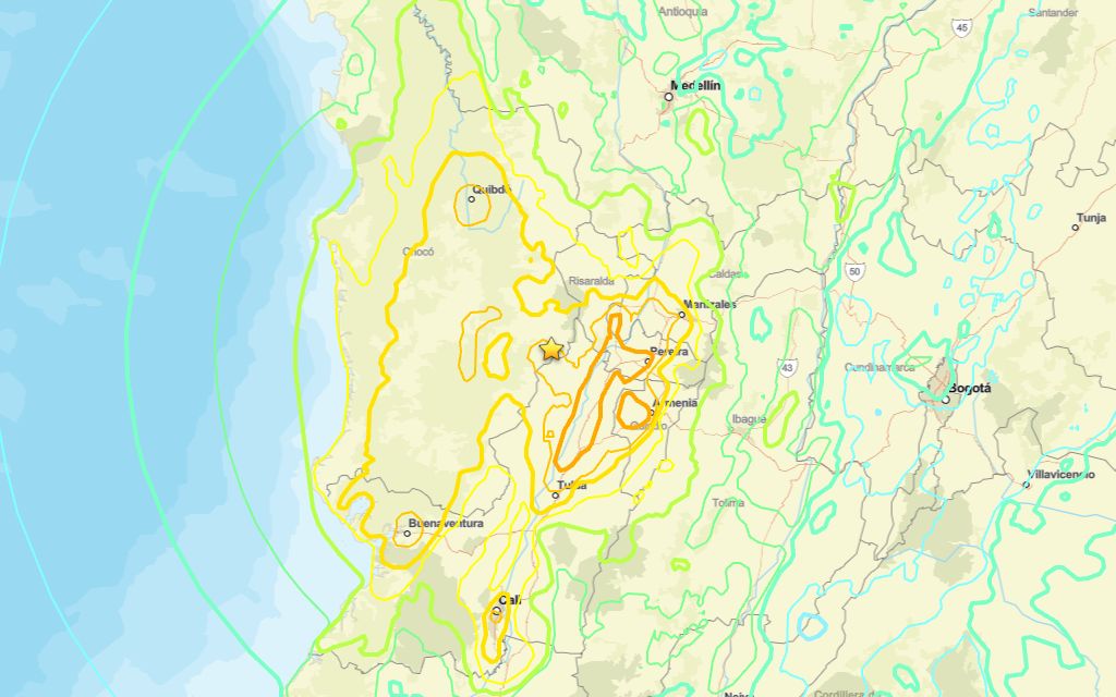
SAN JOSÉ DEL PALMAR, Choco — A 7.4 magnitude quake occurred near San José del Palmar on Monday morning, the U.S. Geological Survey reported.
The tremor hit at 12:34 UTC (07:34 local time), with its epicenter roughly 2 km southeast of San José del Palmar and a depth of 108 km.
Did you feel it?
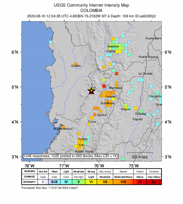
If you felt the earthquake, you can share your experience using the USGS Felt Report form. 1245 people have submitted responses through the agency’s online form, reporting they experienced violent shaking. Residents in several cities — such as Sinop, Chacao, Caracas, Valencia and Guayaquil — reported feeling the quake, according to the USGS DYFI report.
Impact and estimated losses
Red alert for shaking-related fatalities and economic losses. High casualties and extensive damage are probable and the disaster is likely widespread. Past red alerts have required a national or international response Estimated economic losses are 0-8% GDP of Colombia. Recent earthquakes in this area have caused secondary hazards such as landslides and liquefaction that might have contributed to losses.
Structure information summary
Overall, the population in this region resides in structures that are vulnerable to earthquake shaking, though resistant structures exist. The predominant vulnerable building types are mud wall with wood and unknown/miscellaneous types construction.
Detailed tectonic summary
The August 10, 2026, earthquake in western Colombia occurred as the result of primarily strike-slip faulting at a depth of approximately 110 km. Focal mechanism solutions for the event indicate rupture occurred on either a steeply-dipping oblique reverse and left-lateral strike-slip fault, or a moderately-dipping largely right-lateral strike-slip fault. The earthquake occurred in a region characterized by eastward subduction of the Nazca plate beneath the South America plate. Due to its depth, the earthquake likely occurred within the subducting Nazca plate.
While commonly plotted as points on maps, earthquakes of this size are more appropriately described as slip over a larger fault area. Strike-slip earthquakes of the size of the August 10, 2026, event are typically about 105 km x 15 km in size (length x width).
Earthquakes with focal depths between 70 and 300 km, like this event, are commonly termed “intermediate-depth” earthquakes. Intermediate-depth earthquakes represent deformation within subducted slabs rather than at the shallow plate interface between subducting and overriding tectonic plates. Because of their depth, these earthquakes typically cause less intense shaking than shallower earthquakes of the same magnitude; however, the shaking can still be strong, and is typically felt over a broader region. Large, intermediate depth earthquakes are common along the entire length of the South America subduction zone. They are usually attributed to bending forces within the subducted slab. The August 10, 2026, earthquake occurred near the northernmost extent where intermediate depth earthquakes in the South America subduction zone are observed.
Since 1950, there were two previous earthquakes of magnitude 7 or larger within 250 km of this earthquake; however, they were located near the coast of Colombia. The region around the August 10, 2026, earthquake has more typically experienced smaller earthquakes not exceeding magnitude 7. Recent damaging earthquakes in Colombia have included interface subduction earthquakes near the coast and in neighboring Ecuador, as well as shallow crustal earthquakes occurring close to population centers in the country. In 1999, a magnitude 6.1 crustal earthquake near Armenia, Colombia caused over 1000 fatalities, and destroyed around 50 percent of the houses in Pereira, Colombia.
Source: The U.S. Geological Survey