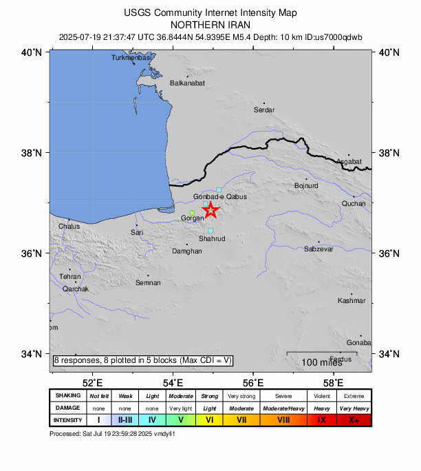
ALIABAD, Golestan Province—Saturday morning, a 5.4 magnitude quake was registered close to Qarnābād, according to the U.S. Geological Survey.
It was reported that a tremor jolted the region at 21:37 UTC (01:07 local time). The epicenter was located approximately 31 km east of Qarnābād, at a depth of 10 km.
Did you feel it?
If you experienced the earthquake, you can share your observations using the USGS Felt Report form. So far, the agency has collected 8 online responses from individuals indicating that they felt the quake. Weak to light shaking was observed in and around the Emamshahr area, where several residents reported experiencing the tremor, according to the USGS DYFI report.
Impact and estimated losses
Green alert for shaking-related fatalities and economic losses. There is a low likelihood of casualties and damage. Recent earthquakes in this area have caused secondary hazards such as landslides that might have contributed to losses.
Structure information summary
Overall, the population in this region resides in structures that are vulnerable to earthquake shaking, though resistant structures exist. The predominant vulnerable building types are adobe block and unreinforced brick with mud and timber post construction.
Historical information
A magnitude 6.5 earthquake 268 km northeast of this event struck Garmkhan, Iran on February 4, 1997 (UTC), with estimated population exposures of 253,000 at intensity VI and 9,000 at intensity VII, resulting in a reported 100 fatalities.
Qarnābād shaken twice last week
Two quakes, each with a magnitude of 4.6, have been detected in the same area in the past week. One rattled one days ago, while the other was reported on July 15.
Source: The U.S. Geological Survey