A 7.3 magnitude quake struck near Luganville on Monday evening, the U.S. Geological Survey reported.
At 08:44 UTC (19:44 local time), a tremor slammed the area at a depth of 121 km, with its epicenter approximately 52 km east-northeast of Luganville. Seismologists first reported it as a 7.2 event, but later upgraded it to 7.3.
Did you feel it?
If you noticed the earthquake, you can report it through the USGS Felt Report form. The agency has received 32 responses on its online form so far, from people indicating they felt moderate to strong shaking. Residents in multiple cities — including Nouméa, Vila and Luganville — reported experiencing the quake, according to the USGS DYFI report.
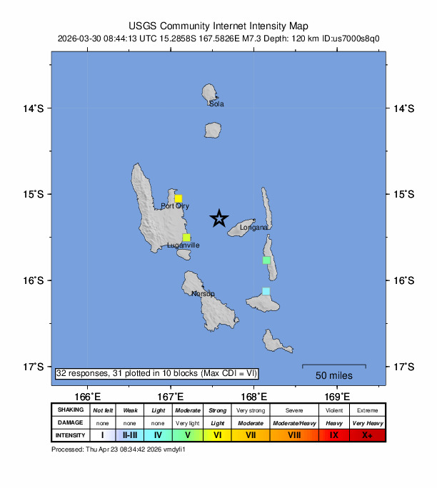
Impact and estimated losses
The USGS categorized this as a Green Alert, which means there is a low likelihood of casualties and damage. Recent earthquakes in this area have caused secondary hazards such as tsunamis and landslides that might have contributed to losses.
Structure information summary
Overall, the population in this region resides in structures that are highly vulnerable to earthquake shaking, though some resistant structures exist. The predominant vulnerable building types are unknown/miscellaneous types and wood construction.
Detailed tectonic summary
The March 30, 2026, M 7.3 earthquake near the island of Espiritu Santo in the Vanuatu island chain of the southwest Pacific Ocean occurred as a result of oblique-thrust faulting near the boundary between the Australia and Pacific plates. Moment tensors of the event indicate that rupture occurred on a north-northwest striking moderately dipping fault or a south-southwest striking steeply dipping fault. The earthquake is located about 90 km to the east of the New Hebrides Trench, the bathymetric expression of the plate boundary between the Australia and Pacific plates, where the lithosphere of the Australia plate subducts into the mantle beneath the North Fiji Basin. At the location of this earthquake, the Australia plate moves east-northeast with respect to the Pacific plate at a velocity of approximately 80 mm/yr.
Earthquakes like this one, with focal depths between 70 and 300 km, are commonly termed “intermediate-depth” earthquakes. Intermediate-depth earthquakes often represent deformation within subducted slabs rather than at the shallow plate interfaces between subducting and overriding tectonic plates. They typically cause less damage on the ground surface above their foci than is the case with similar-magnitude shallow-focus earthquakes, but large intermediate-depth earthquakes may be felt at great distances from their epicenters.
The Vanuatu region frequently experiences large earthquakes; 19 events of M 7 or larger have occurred within 150 km of this March 30, 2026, event over the preceding century. The largest was a M 7.7 earthquake in May 1965, 75 km to the north-northwest of the March 30, 2026, event.
Source: The U.S. Geological Survey