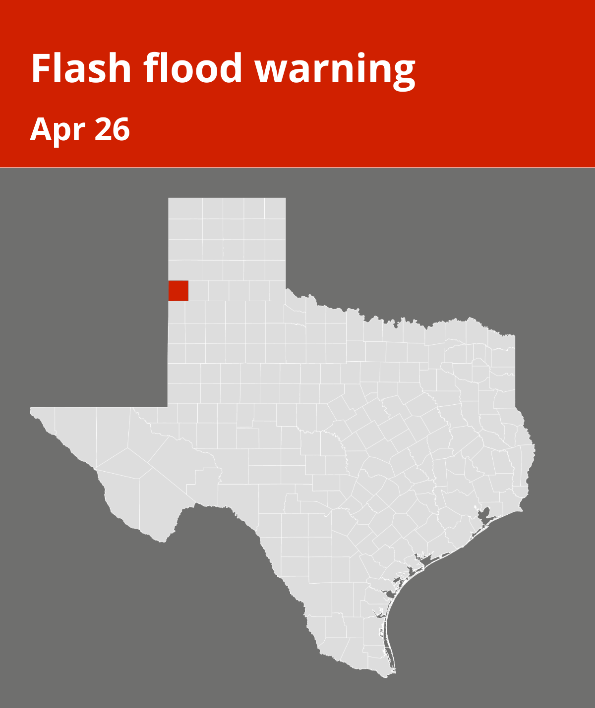
The National Weather Service released an updated flash flood warning at 10:32 p.m. on Friday in effect until 11:45 p.m. for Parmer County.
“At 10:32 p.m., Doppler radar indicated thunderstorms producing heavy rain across the warned area. Between 2 and 4 inches of rain have fallen. Additional rainfall amounts of 1 to 2 inches are possible in the warned area. Flash flooding is ongoing or expected to begin shortly,” says the NWS. “Flash flooding of small creeks and streams, urban areas, highways, streets and underpasses as well as other poor drainage and low-lying areas.”
The warning is for Rhea.
The NWS adds, “Turn around, don’t drown when encountering flooded roads. Most flood deaths occur in vehicles. Be especially cautious at night when it is harder to recognize the dangers of flooding. Be aware of your surroundings and do not drive on flooded roads.”
Breaking down weather alerts: advisories, watches, and warnings
• Flash flood warning: Take action!
A flash flood warning is issued when a flash flood is imminent or occurring. If you are in a flood-prone area, move immediately to high ground. A flash flood is a sudden violent flood that can take from minutes to hours to develop. It is even possible to experience a flash flood in areas not immediately receiving rain.
• Flood warning: Take action!
A flood warning is declared when flooding is on the verge of happening or is already underway.
• Flood advisory: Be aware:
A flood advisory is issued when flooding is not expected to be bad enough to issue a warning. However, it may cause significant inconvenience, and if caution is not exercised, it could lead to situations that may threaten life and/or property.
• Flood watch: Be prepared:
A flood watch is issued when conditions are favorable for flooding. It doesn’t guarantee that flooding will occur, but it signifies that the possibility exists.
Be flood-ready: Expert guidance from the NWS for your safety
In flood-prone regions or while camping in low-lying areas, understanding and following the NWS flood safety guidelines can be a lifesaver:
Seek higher ground:
If you’re in a flood-prone area, or if you’re camping in a low-lying spot, move to higher ground as a first step.
Follow evacuation orders:
If local authorities issue an evacuation order, heed it promptly. Prior to leaving, secure your home by locking it.
Disconnect utilities and appliances:
If time allows, disconnect your utilities and appliances. This reduces the risk of electrical hazards during flooding.
Avoid basements and submerged areas:
Steer clear of basements or rooms where water has submerged electrical outlets or cords. This helps prevent electrical accidents.
Evacuate promptly for safety:
If you notice sparks or hear buzzing, crackling, snapping, or popping noises, evacuate immediately. Avoid any water that may be charged with electricity.
Refrain from walking in floodwaters:
Never attempt to walk through floodwaters, even if they appear shallow. Just 6 inches of fast-moving water can forcefully sweep you off your feet.
Seek higher ground when trapped:
Should you become trapped by moving water, reach the highest point possible and dial 911 to contact emergency services.
During heavy rain, flooding is possible, especially in low-lying and flood-prone areas. Never drive through water on the road, even if it does not appear to be deep. It takes just 12 inches of rushing water to carry away most cars, according to the NWS. Stay safe by being prepared and informed.
Rainy roadways ahead: Essential safety tips for heavy rain
When heavy rain pours, the risk of flooding and treacherous roads rises. Here’s your guide from the NWS to staying safe during downpours:
Beware of swollen waterways:
Avoid parking or walking in close proximity to culverts or drainage ditches, as the swiftly moving water during heavy rain can potentially carry you away.
Maintain safe driving distances:
The two-second rule for following distance is your ally in heavy rain. Extend it to four seconds to ensure safe spacing in adverse conditions.
Reduce speed and drive cautiously:
On wet roads, reducing your speed is crucial. Ease off the gas pedal gradually and avoid abrupt braking to prevent skidding.
Choose your lane wisely:
Stick to the middle lanes to minimize the risk of hydroplaning. Outer lanes are more prone to accumulating water.
Visibility matters:
Enhance your visibility in heavy rain by turning on your headlights. Watch out for vehicles in blind spots, as rain-smeared windows can obscure them.
Watch out for slippery roads:
The first half-hour of rain is when roads are slickest due to a mix of rain, grime, and oil. Exercise heightened caution during this period.
Keep a safe distance from large vehicles:
Don’t follow large trucks or buses too closely. The spray created by their large tires reduces your vision. Take care when passing them as well; if you must pass, do so quickly and safely.
Mind your windshield wipers:
• Overloaded wiper blades can hinder visibility. If rain severely impairs your vision, pull over and wait for conditions to improve. Seek refuge at rest areas or sheltered spots.
• When stopping by the roadside is your only option, position your vehicle as far off the road as possible, ideally beyond guardrails. Keep your headlights on and activate emergency flashers to alert other drivers of your position.
By following these safety measures, you can significantly reduce risks and ensure your well-being when heavy rain pours down. Stay informed about weather conditions and heed advice from local authorities to make your journey safe and sound.
Source: The National Weather Service