Article first published: Sunday, Oct. 11, 2026, 4 a.m. ET
Article last updated: Sunday, Oct. 11, 2026, 10 a.m. ET
System type: Post-tropical cyclone
System name: Isaias
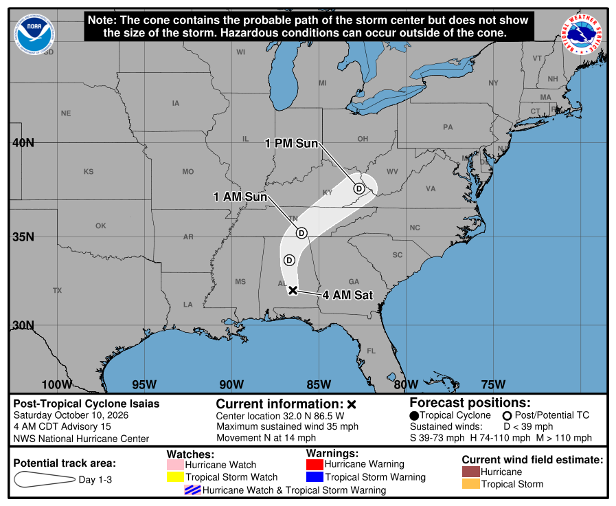
The post-tropical cyclone system was last addressed in a final advisory by the National Hurricane Center at 10 a.m. Sunday. Isaias weakened and had devolved from a Category 1 hurricane into a post-tropical cyclone with sustained winds of 25 mph. Isaias transited Tennessee and entered Kentucky. Post Tropical Cyclone Isaias is 180 miles northeast of Nashville Tennessee. Packing maximum sustained winds of 25 mph, it is tracking to the east-northeast at 22 mph.
“Little change in strength is forecast during the next 12 hours, with the low dissipating thereafter,” analysts explained.
Hazards affecting land
Rainfall. Additional rainfall of 1 to 3 inches is possible today across portions of the Central Appalachians into the Mid-Atlantic, with localized flash and urban flooding possible. In western North Carolina, rainfall is diminishing, but rapid river rises and flooding remain possible today.
For a complete forecast of rainfall associated with Isaias, please see the National Weather Service Storm Total Rainfall Graphic available at hurricanes.gov/graphics_at4.shtml?rainqpf and the Flash Flood Risk graphic at hurricanes.gov/graphics_at4.shtml?ero.
For a list of rainfall observations (and wind reports) associated with Isaias, see the companion storm summary at WBCSCCNS4 with the WMO header ACUS44 KWBC or at the following link: www.wpc.ncep.noaa.gov/discussions/nfdscc4.html.
Tornadoes. A couple of tornadoes are possible today across the Piedmont and Coastal Plain of Virginia and North Carolina.
Surf. Swells from Isaias will continue to affect much of the Gulf and Southeast coasts of the United States today. These swells are likely to cause life-threatening surf and rip current conditions.
A depiction of rip current risk for the United States can be found at: hurricanes.gov/graphics_at4.shtml?ripCurrents
Source: National Hurricane Center