Article first published: Friday, Sept. 25, 2026, 4 a.m. ET
Article last updated: Friday, Sept. 25, 2026, 1 p.m. ET
System type: Tropical storm
System name: Gonzalo
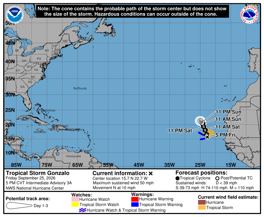
According to the National Hurricane Center’s 1 p.m. Friday advisory, Tropical Storm Gonzalo is in the Atlantic Ocean, 70 miles south of Sal Cabo Verde. With maximum sustained winds of 50 mph, the system is moving north at 10 mph.
“… the center will pass near or over the eastern portions of the Cabo Verde Islands later today and tonight,” according to meteorologists. “Little change in strength is expected today.” They also said “A gradual weakening trend is forecast to begin tonight and continue through the weekend.”
Yesterday (Thursday)
Yesterday (Thursday) at 10 pm, the National Hurricane Center published the first advisory for a tropical storm.
Forecasters alert of a tropical storm warning issued for the Cabo Verde Islands.
Warning currently in effect
Tropical Storm Warning for The Cabo Verde Islands
Meaning of the warning
A Tropical Storm Warning means that tropical storm conditions are expected somewhere within the warning area.
Hazards affecting land
Wind. Tropical storm conditions will continue over portions of the Cabo Verde Islands through tonight.
Rainfall. Tropical Storm Gonzalo is expected to produce rainfall totals of 1 to 3 inches (25 to 75 mm) across the eastern portions of the islands of Cabo Verde on Friday and Saturday with less than 1 inch anticipated for the western side of the island chain. Heavy rain along the coastal areas of Guinea-Bissau, Gambia, and Senegal will produce totals between 2 to 4 inches (50 to 100 mm) with isolated higher amounts along the immediate coast.
Surf. Swells generated by the storm are expected to affect the Cabo Verde Islands through Saturday. These swells are likely to cause life-threatening surf and rip current conditions.
Source: National Hurricane Center