Article first published: Wednesday, Sept. 2, 2026, 4 a.m. ET
System type: Tropical depression
System name: Edouard
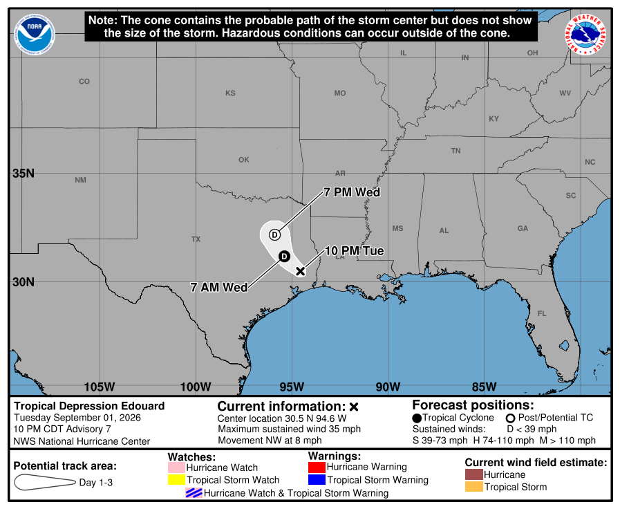
At 4 a.m. Wednesday, the National Hurricane Center released its first advisory of the day for the system, reporting that Tropical Depression Edouard is 70 miles northwest of Beaumont, Texas and 30 miles south-southwest of Lufkin, Texas. With maximum sustained winds of 35 mph, it is moving north-northwest at 5 mph.
“Continued weakening is expected over the next 24 hours, as Edouard is forecast to dissipate Wednesday night,” analysts stated.
Yesterday (Tuesday)
Edouard became a tropical depression with sustained winds of 35 mph after weakening from a tropical storm.
Hazards affecting land
Wind. Wind gusts to tropical-storm force may continue near the center of Edouard for the next several hours.
Rainfall. Total rainfall along Edouard’s path is expected to range from 4 to 8 inches, with maximum totals up to 12 inches for parts of the Upper Texas Coast inland through east-central Texas. This rainfall is likely to produce flash flooding, especially in low-lying and urban areas. Significant flash flooding is possible. River flooding may also be possible.
Across Southwest Louisiana, total rainfall from Edouard will range from 2 to 4 inches.
For a complete forecast of rainfall associated with Edouard, please see the National Weather Service Storm Total Rainfall Graphic available at hurricanes.gov/graphics_at5.shtml?rainqpf and the Flash Flood Risk graphic at hurricanes.gov/graphics_at5.shtml?ero.
For a list of rainfall observations (and wind reports) associated with Edouard, see the companion storm summary at WBCSCCNS5 with the WMO header ACUS45 KWBC or at the following link: www.wpc.ncep.noaa.gov/discussions/nfdscc5.html.
Tornadoes. A brief tornado or two may occur through early Wednesday morning across parts of southwest Louisiana and southeast Texas.
Source: National Hurricane Center