A 7.4 magnitude quake struck close to Miyako on Monday afternoon, according to the U.S. Geological Survey.
The tremor, which slammed the region at 07:52 UTC (17:52 local time), was centered roughly 98 km east-northeast of Miyako. It occurred at a depth of 25 km.
Did you feel it?
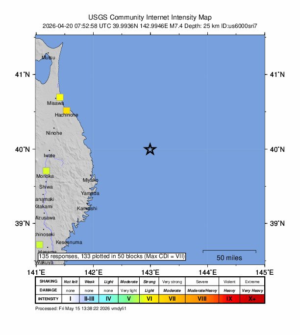
If you noticed the earthquake, you can report it through the USGS Felt Report form. The agency has so far received 135 reports via its online form from people who report they felt strong to very strong shaking. Residents in several cities — such as Nagoya, Chigasaki, Fujisawa, Yokohama and Fuchū — reported experiencing the quake, according to the USGS DYFI report.
Impact and estimated losses
The USGS categorized this as a Green Alert, which means there is a low likelihood of casualties and damage. Recent earthquakes in this area have caused secondary hazards such as tsunamis, landslides and fires that might have contributed to losses.
Structure information summary
Overall, the population in this region resides in structures that are resistant to earthquake shaking, though vulnerable structures exist. The predominant vulnerable building types are heavy wood frame and reinforced/confined masonry construction.
Detailed tectonic summary
The April 20, 2026, M 7.4 earthquake offshore of Miyako, Japan, occurred as the result of thrust faulting near the subduction zone interface plate boundary between the Pacific and North America plates. Moment tensor solutions are consistent with the east-west oriented compression expected in this region and suggest slip occurred along the plate interface. At the location of this earthquake, the Pacific plate moves approximately westward relative to the North America plate at a velocity of 83 mm/yr, subducting beneath Japan at the Japan Trench and dipping to the west beneath Japan. Note that some researchers divide this region into several microplates that together define the relative motions among the larger Pacific, North America, and Eurasia plates; these include the Okhotsk and Amur microplates local to this earthquake that are part of North America and Eurasia, respectively.
While commonly plotted as points on maps, earthquakes of this size are more appropriately described as slip over a larger fault area. Reverse (thrust) faulting events of the size of the April 20, 2026 earthquake are typically about 70 km long by 35 km wide in size.
The region around this M7 April 20, 2026 earthquake is active and has hosted many larger (M7+) earthquakes. In the past 100 years, 36 earthquake M7 and larger have occurred within 250 km of this event. Notably, this April 20, 2026 earthquake occurred 192 km to the north of the March 11, 2011 M9.1 Tohoku earthquake. The much larger March 2011 M9.1 earthquake generated a deadly tsunami that led to extensive destruction along the Japanese coast and propagated throughout the Pacific Ocean basin. Approximately 16,000 people perished because of the earthquake and subsequent tsunami. More recently, the M7.6 December 8 2025 Aomori Prefecture earthquake occurred 137 km to the north-northwest of this April 20 2026 event and resulted in at least 32 injuries and 4000 buildings damaged.
Source: The U.S. Geological Survey