YUPILTEPEQUE, Jutiapa Department — A 5.6 magnitude quake was recorded near Jerez Tuesday afternoon, according to the U.S. Geological Survey.
The tremor struck at 21:21 UTC (15:21 local time), with its epicenter located approximately 4 km west-northwest of Jerez and a depth of 12 km.
Did you feel it?
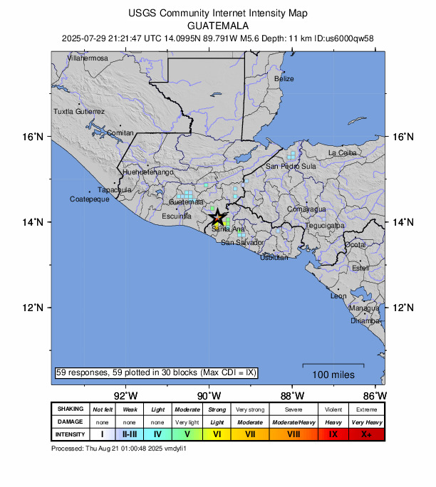
If you noticed the earthquake, you can share your observations using the USGS Felt Report form. So far, the agency has collected 59 online responses from individuals indicating that they felt the quake. The USGS DYFI report indicates that moderate shaking was detected, with people in Yaguacire, San Pedro Sula, Zapotal del Norte, Mixco and Chinautla among those who felt the tremor.
Impact and estimated losses
Yellow alert for economic losses. Some damage is possible and the impact should be relatively localized. Estimated economic losses are less than 1% of GDP of El Salvador. Past events with this alert level have required a local or regional level response. Green alert for shaking-related fatalities. There is a low likelihood of casualties. Recent earthquakes in this area have caused secondary hazards such as landslides that might have contributed to losses.
Structure information summary
Overall, the population in this region resides in structures that are highly vulnerable to earthquake shaking, though some resistant structures exist. The predominant vulnerable building types are mud wall and adobe block construction.
Historical information
A magnitude 7.5 earthquake 72 km northeast of this event struck Guatemala on February 4, 1976 (UTC), with estimated population exposures of 1,017,000 at intensity VIII and 80,000 at intensity IX or greater, resulting in a reported 22,778 fatalities.
Source: The U.S. Geological Survey